Element I: Testing, Data Collection and Analysis
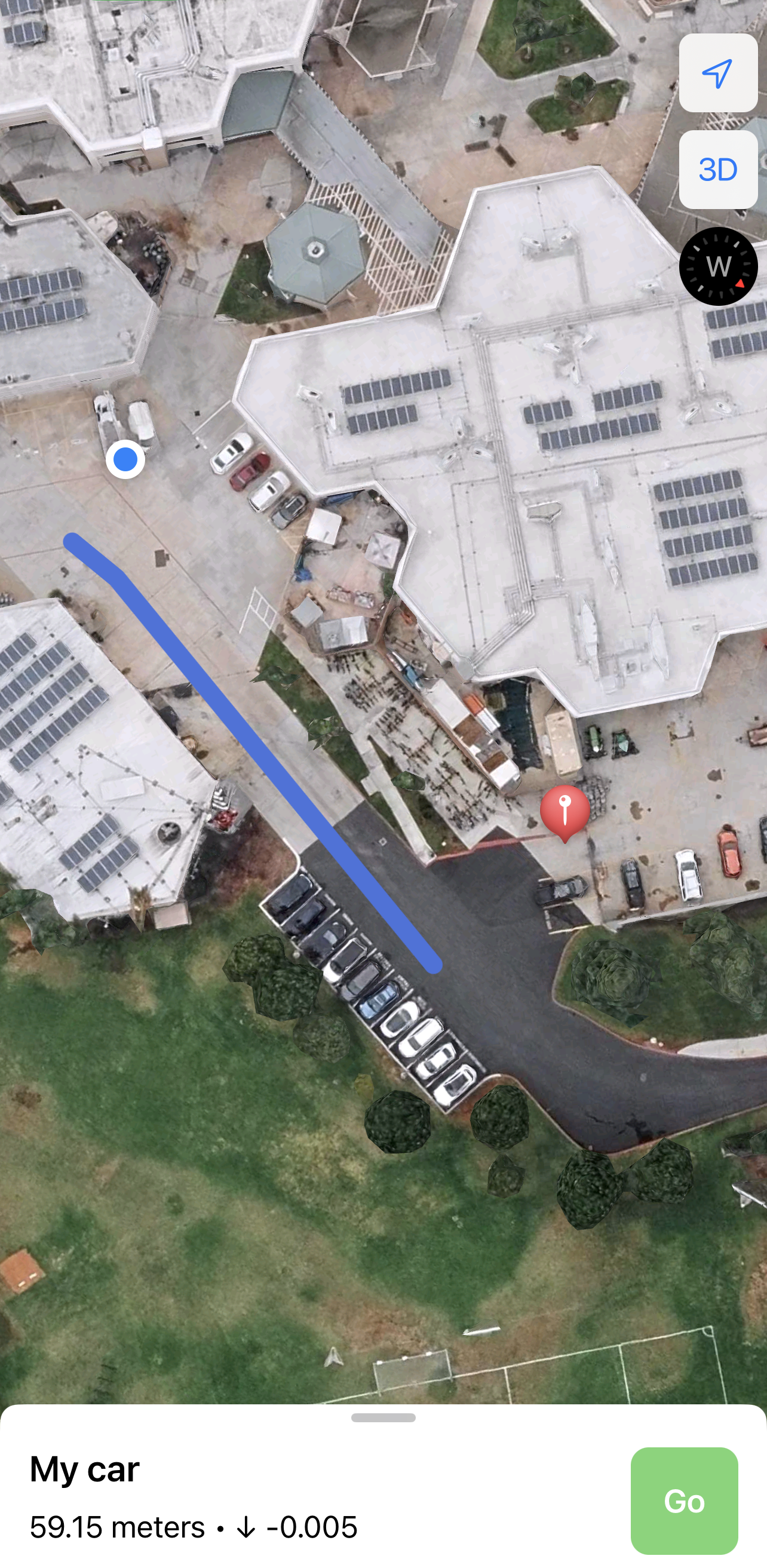
Test #1 - UA9 at Irvine High School
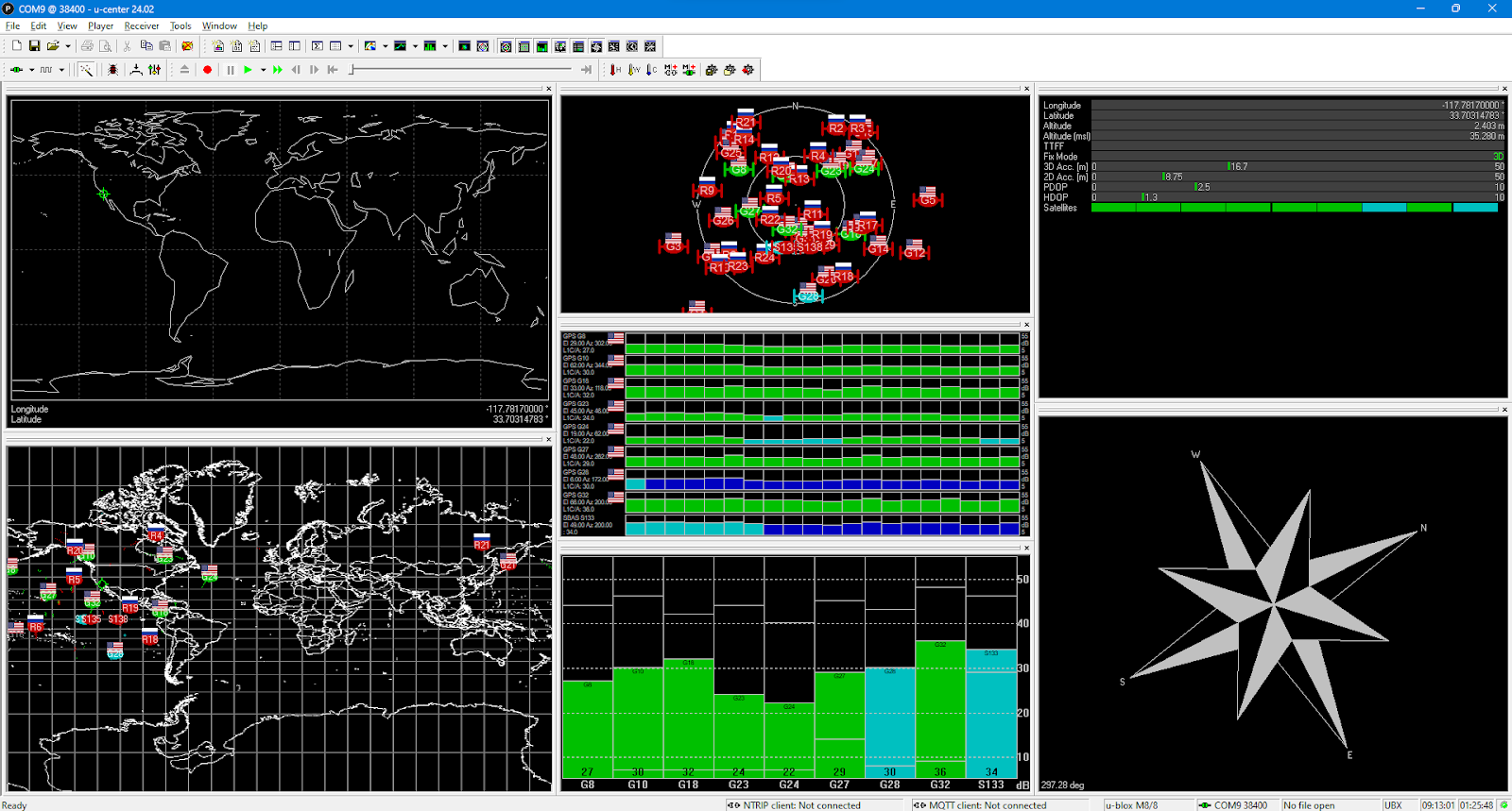
The purpose of this test will be that of a general diagnostics test. The classroomєs dimensions make it nigh impossible to truly test the full capabilities of the device. Thus, the classroom test will be a quick and easy one in order to simply make sure everything is working accordingly.
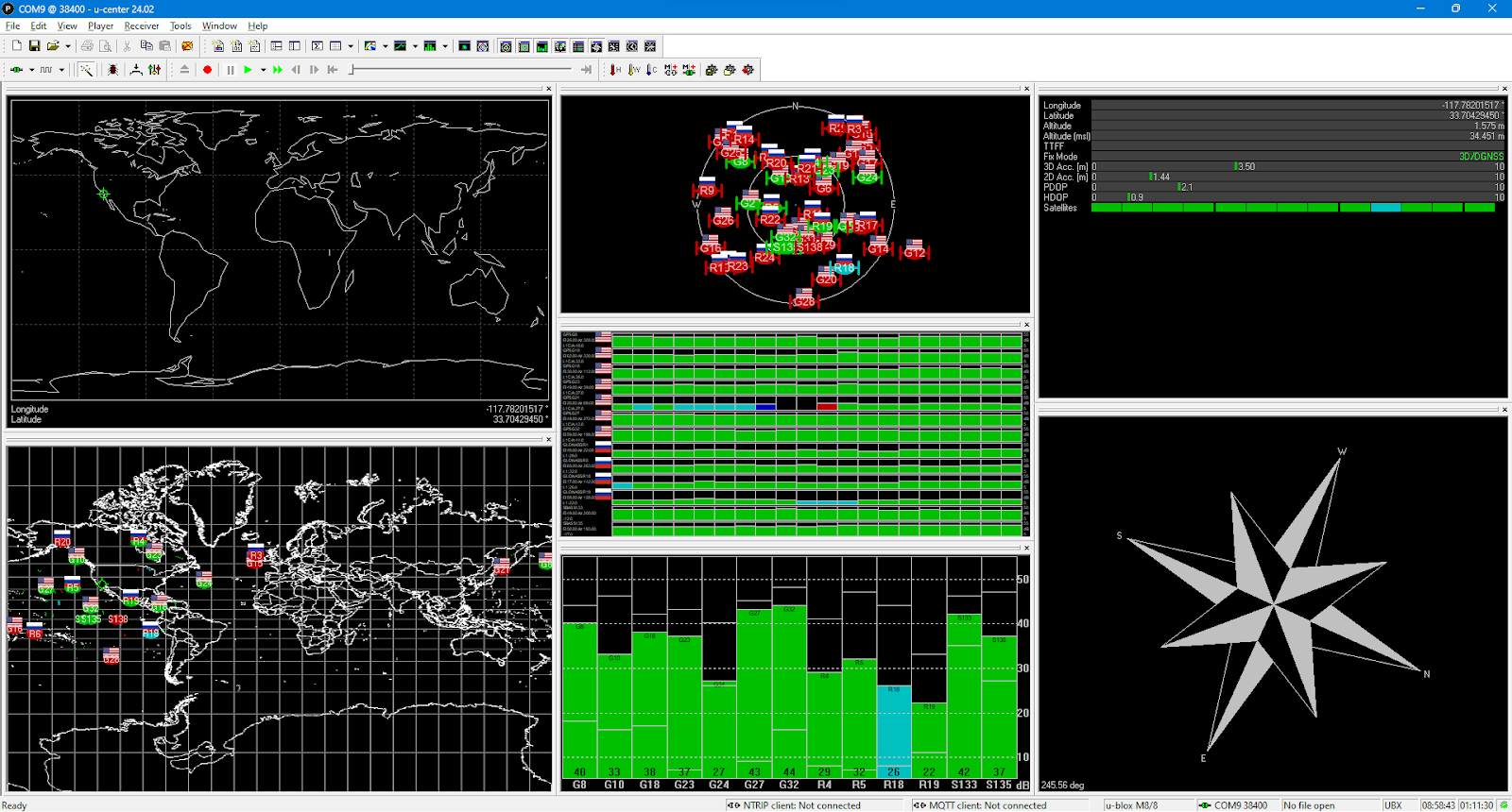
Result: Location calculations were accurate, the path was drawing well, and the elevation had a bit of error.
| Criteria | Actual (True) | Calculated through device/phone | Error (m) | ||
|---|---|---|---|---|---|
| Device | Longitude | -117.7808595 | -117.7817 | 0.0933890995 | |
| Latitude | 33.70288944 | 33.70314783 | -0.0287099843 | ||
| Elevation (m) | 35 | 35.28 | 0.28 | ||
| Phone | Longitude | -117.7808595 | -117.781667 | 0.0897224365 | |
| Latitude | 33.70288944 | 33.702500 | 0.04327105483 | ||
| Elevation (m) | 0 | -0.005 | 0.005 | ||
| How well is the path generated by the phone accurate? Corresponding to reality, GPS data, etc. | |||||
| Path device-to-phone | Overall, the path drawn was highly accurate and regularly updated, pointing from the real-time location of the user to the received location of the car. | ||||
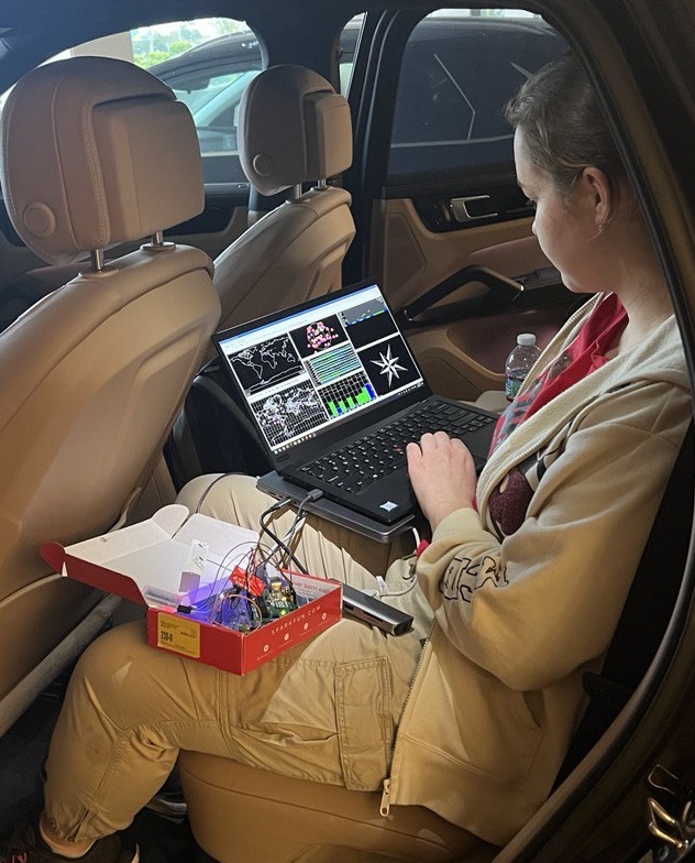
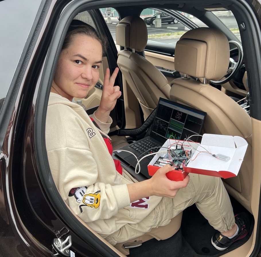
Process pictures:
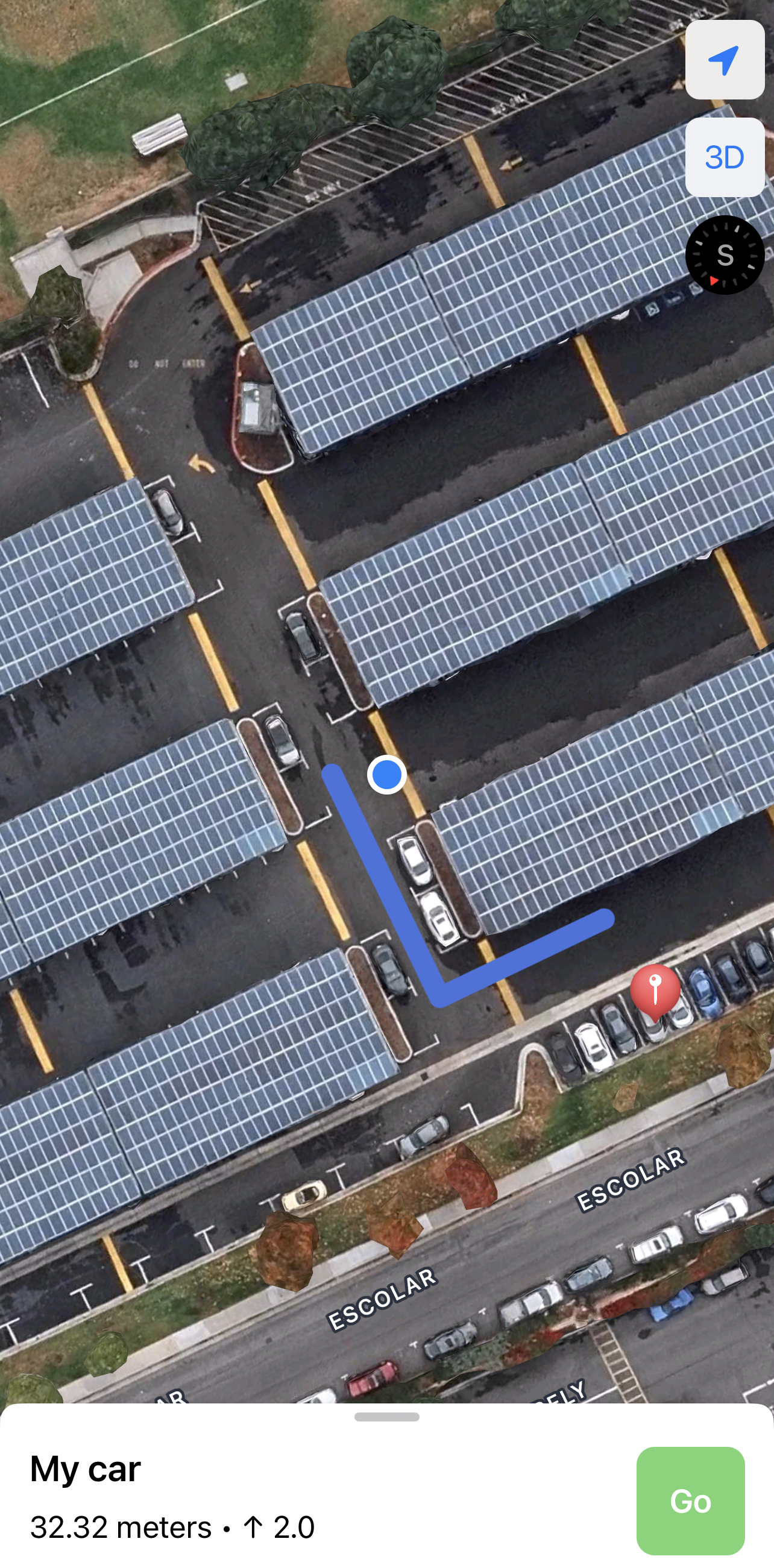
Test #2 - Irvine High School Parking Lot
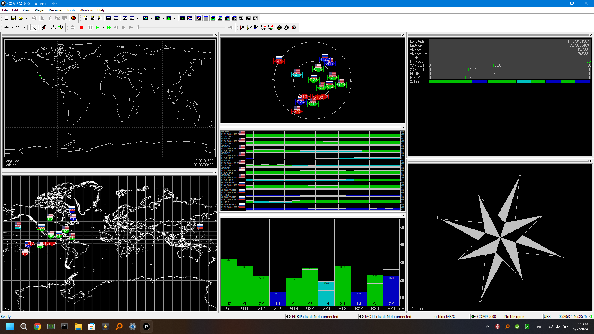
The purpose of this test will be to determine the frameworks of the device's general range and accuracy. The larger parking lot's dimensions make it easier to truly test the full capabilities of the device. Thus, the Irvine High Parking Lot test should serve as a relatively quick and easy one in order to simply lay a solid foundation for future tests.
Result: Accurate location calculation and elevation both on the device and mobile application. High functionality.
| Criteria | Actual (True) | Calculated through device/phone | Error (m) | ||
|---|---|---|---|---|---|
| Device | Longitude | -117.782241 | -117.7820078 | -0.0259110852 | |
| Latitude | 33.7023699 | 33.70428533 | -0.2128253427 | ||
| Elevation (m) | 34 | 34.899 | -0.899 | ||
| Phone | Longitude | -117.7822419 | -117.781667 | -0.0638777139 | |
| Latitude | 33.7023699 | 33.704167 | -0.1996775781 | ||
| Elevation (m) | 0 | 1 | -1 | ||
| How well is the path generated by the phone accurate? Corresponding to reality, GPS data, etc. | |||||
| Path device-to-phone | Overall, the path drawn was highly accurate and regularly updated, pointing from the real-time location of the user to the received location of the car. | ||||
Process pictures:
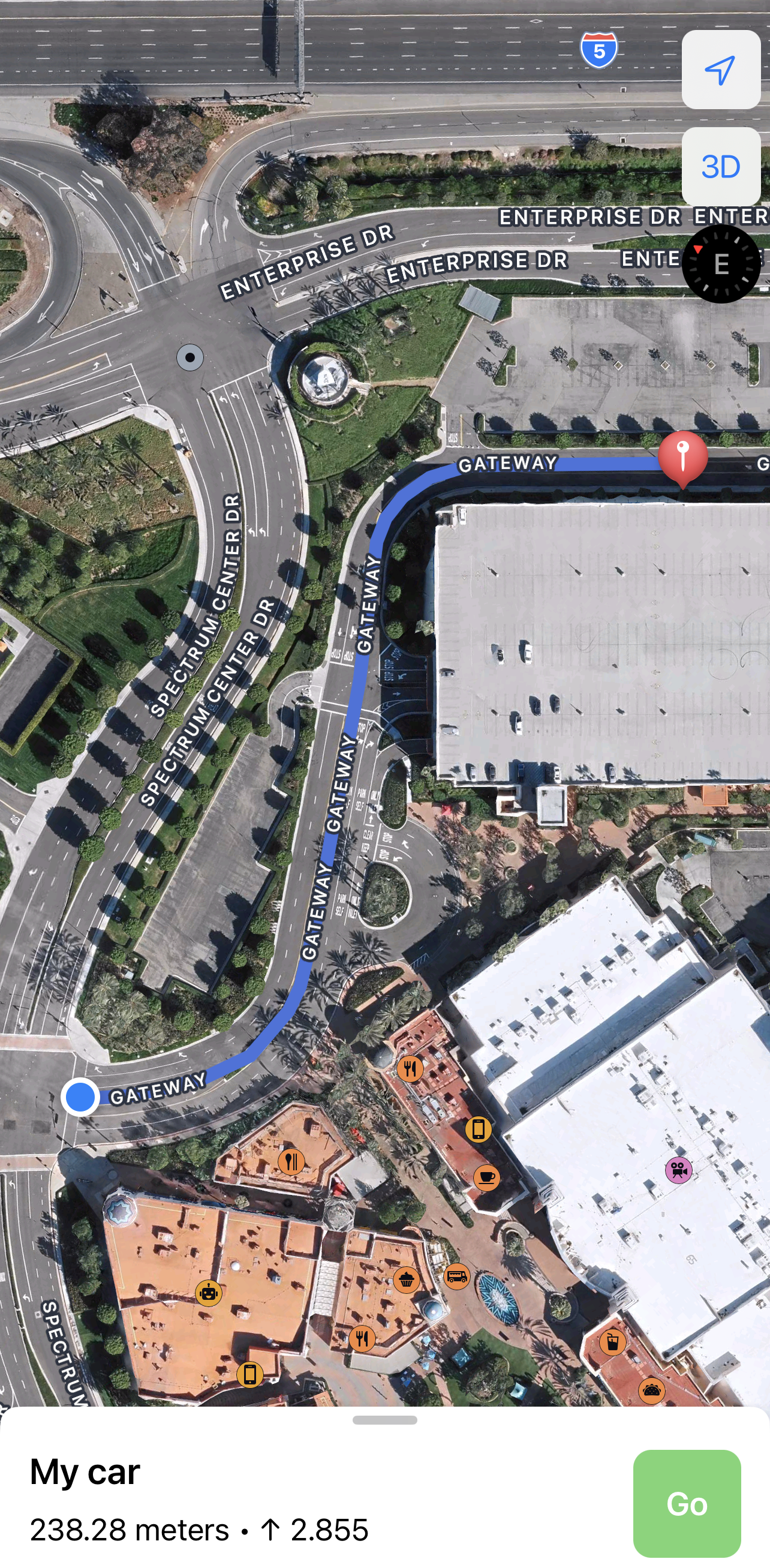
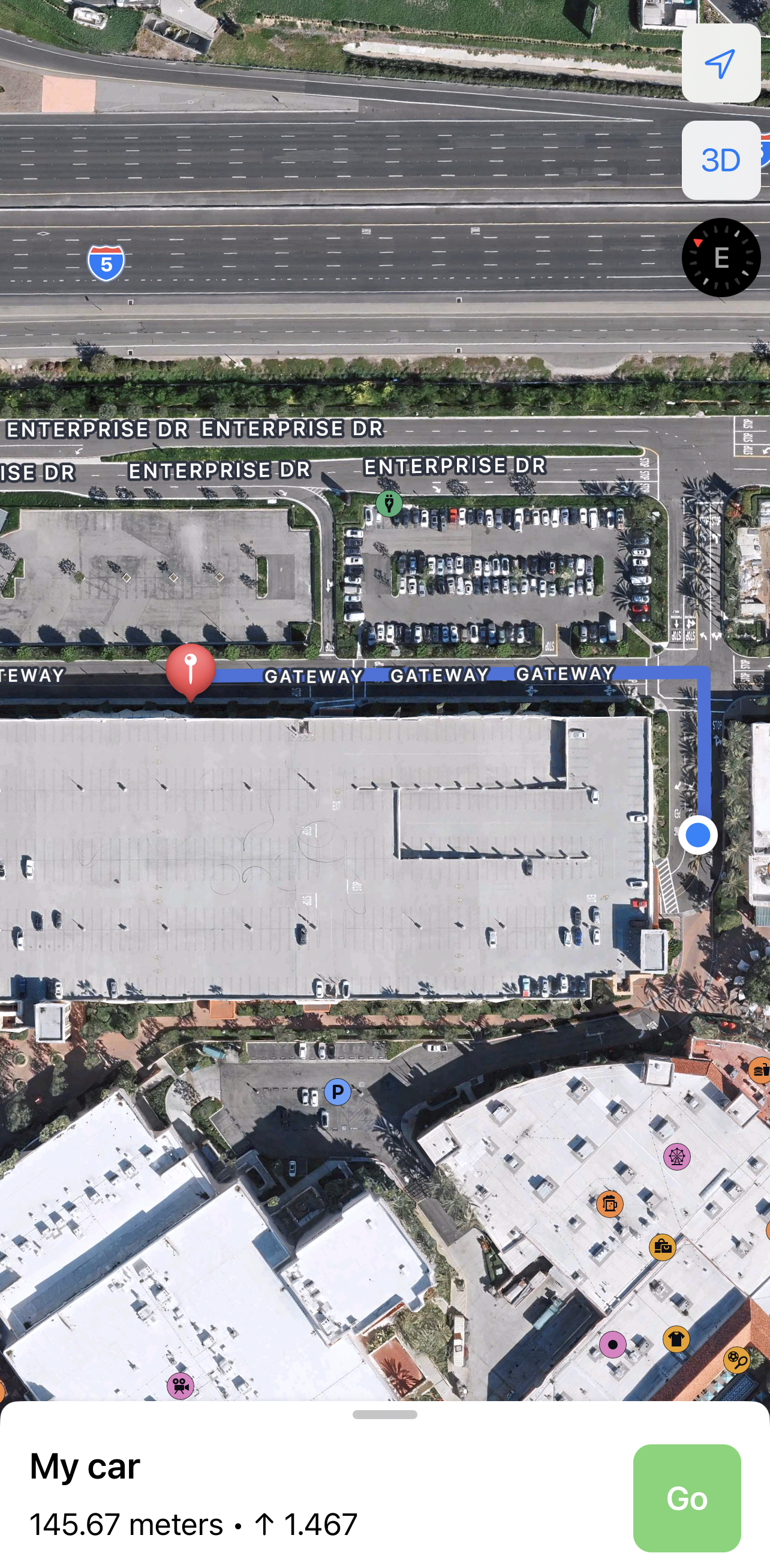
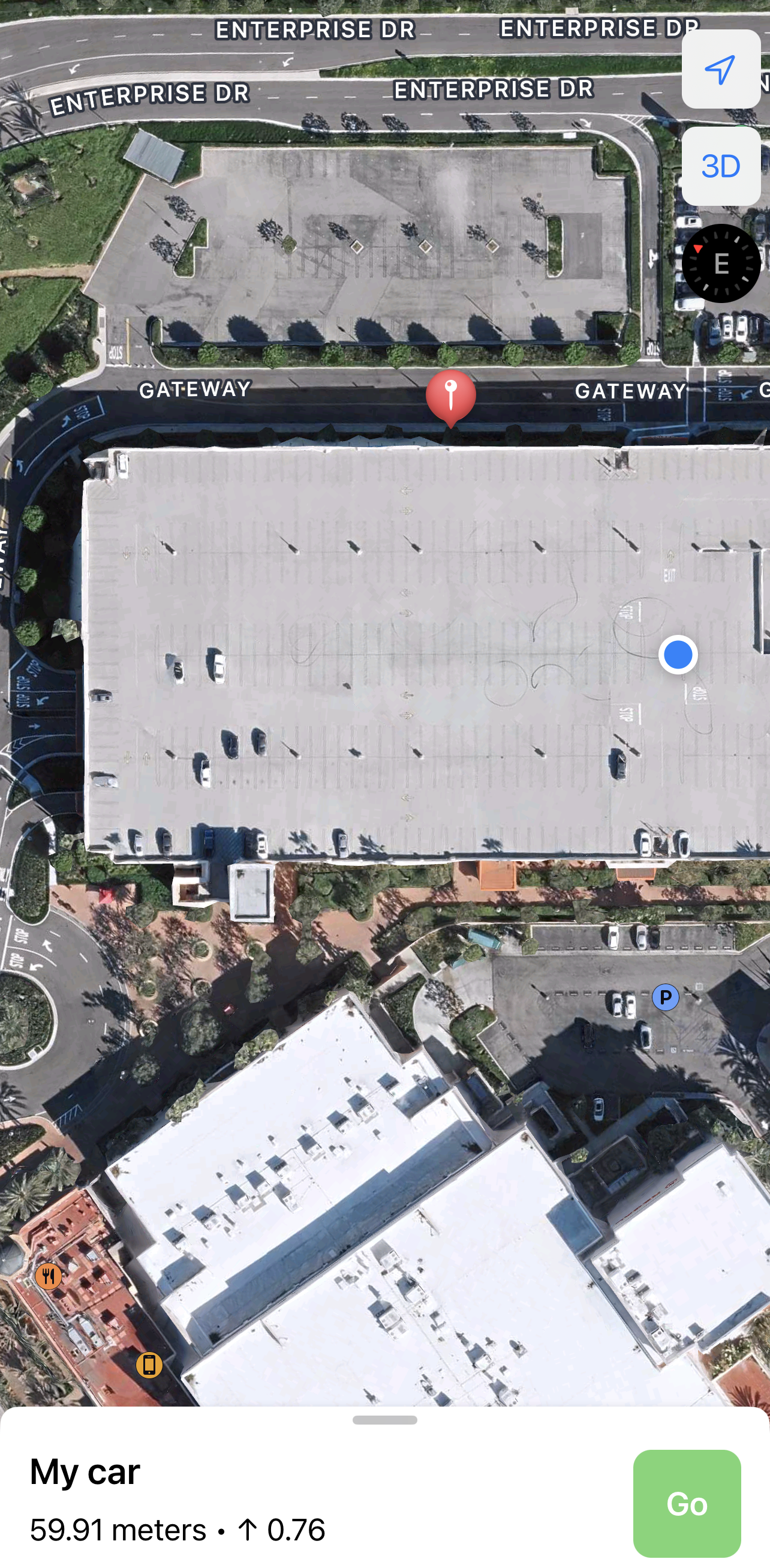
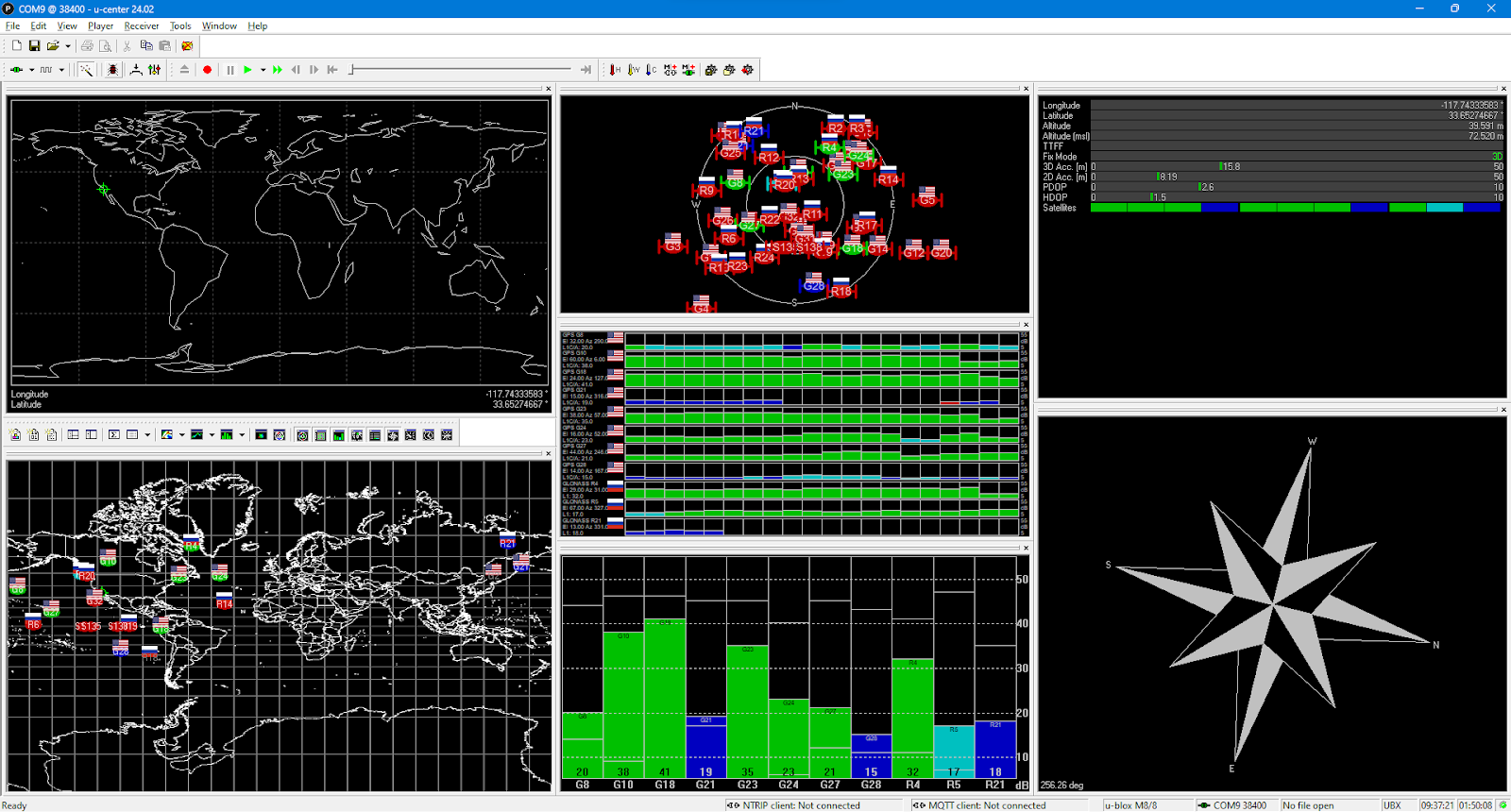
Test #3 - Spectrum Parking Lot
The purpose of this test will be to obtain a more thorough reading of the device's range and accuracy and of how it fairs dealing with multiple stories. The parking lot's additional y-axis allows the team to test the device's capabilities in determining its altitude. Thus, the Spectrum Parking Lot test should serve as a far more comprehensive assessment of how the device will function in the wild.
Result: Location calculations were accurate, the path was drawing well, and the elevation had a bit of error.
| Criteria | Actual (True) | Calculated through device/phone | Error (m) | ||
|---|---|---|---|---|---|
| Device | Longitude | -117.7475 | -117.7434118 | -0.4542439902 | |
| Latitude | 33.651389 | 33.6527899 | -0.1556553999 | ||
| Elevation (m) | 68 | 69 | -1 | ||
| Phone | Longitude | -117.748056 | -117.748056 | 0 | |
| Latitude | 33.6526 | 33.65267299 | -0.00810999189 | ||
| Elevation (m) | 0 | 0.76 | -0.76 | ||
| How well is the path generated by the phone accurate? Corresponding to reality, GPS data, etc. | |||||
| Path device-to-phone | Since the path tracking inside the building using Google Maps or another service is a bit challenging, the path was mainly drawn outside of the building. However the location of the car was accurate and the location of the user was constantly updating, meaning that it will still help the user navigate to its car. | ||||
Process pictures:
Process pictures: